I’ve done the Mini six times, I have lots of data…
Here is the motoactv screenshot of the course elevation:
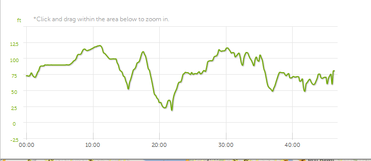
If you want to see more details, click here and you can zoom in each mile, really close. Just pick Elevation on the left where it says Pace, and then Laps/Stages on the left (below) and see each miles elevation on top. I promise you it’s very helpful and easy.
If you want the Garmin version, here:
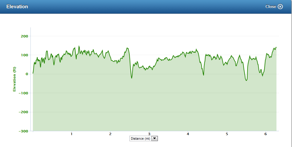
and more details on the garmin site here.
But I think the Lap view in the motoactv link is better, because you can zoom in and separate each mile. If this is too much, just watch it for the reverse climb of Harlem hill (at around 2.2) and then the climb pretty much all 3 to 4 miles. And there are a few rolling hills on the east/south side of the park. So, hills and then some hills: good luck to us all!


Leave a reply to Race Report: NYRR Oakley Mini 10K | runningandthecity Cancel reply